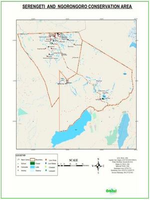
Serengeti Mapping Project
Mr. Bill Given from The Wild Source had contacted and contracted Orbital to carry out GIS mapping in Nduta, Ngorongoro, North Serengeti, Tabora, L. Eyasi, N. Maasai Mara areas in Kenya and Tz.
More Details... Photos VIEW PROJECT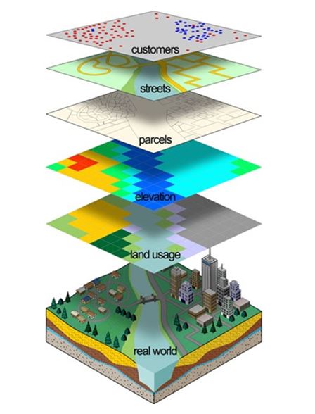
Tifa Research GIS Mapping Project
The GIS data for CBWs was collected in Kakamega, Nairobi, Kilifi & Busia counties using Epicollect GIS app. The GIS database was created; the HIV prevalence data was analysed & maps produced.
More Details... Photos VIEW PROJECT
Masese Company Land Survey
The assignment was carried out Bomet County on May-June 2019. The project entailed property boundary re-establishment, beaconing and Sub-division survey. Three title deeds were produced.
More Details... Photos VIEW PROJECT
Powerline Route Surveys in Kenya
In the period of September 2013 to May 2017, Orbital Africa was contracted by Rural Electrification Authority (REA) to carry out powerline route survey and mapping in Meru, Kisumu and Machakos Counties.
More Details... Photos VIEW PROJECT