 Android App
Android App
Android App
"Dear Esteemed Client, at Orbital Africa, we offer myriad of Geoinformation Training Courses such as Drone Mapping, Cartography, GIS Mapping... Find here a full list of GIS Courses we Offer!
Android App
As a premier Geospatial, Geomatics and GIS services provider, Orbital Africa is the leading land surveying and GIS Mapping company headquartered in Nairobi, Kenya and Branches in Uganda, Tanzania, Ethiopia, Rwanda, Somalia, Botswana, Democratic Republic of Congo (DRC), South Sudan and Ghana. Orbital ranks among the best
in designing client tailored GIS database solutions, mapping, training and an array of professional services which provide the best compromise between
cost, speed and reliability. We offer an array of Geospatial solutions in areas that include: land and topographical surveying services, GIS mapping; Advanced GIS web mapping; Aerial, Drone Mapping and Survey;
and remote sensing services; map production services; enterprise GIS solutions; 3D mapping; project planning and
management; GIS data capture and mobile mapping; spatial and land use planning, GIS training, sale and hire of Survey Equipment; advanced Geospatial consultancy and technical support services.
 As the best rated GIS, mapping, land survey, topo survey and Geospatial services company provider in Kenya and Africa at large,
Orbital is led by a diverse management team with a broad base of business and technical experience in Geospatial industry solutions. Our management
team provides strategic and tactical advice in project execution thus fostering competency in service delivery. We deeply believe in quality, honesty,
reliability and accuracy in delivery of services and solutions to our clients within agreed time period. We take care of the clients' needs in our
collaborations and endeavour to create a positive impact in every interaction we engage in.
More >>>
As the best rated GIS, mapping, land survey, topo survey and Geospatial services company provider in Kenya and Africa at large,
Orbital is led by a diverse management team with a broad base of business and technical experience in Geospatial industry solutions. Our management
team provides strategic and tactical advice in project execution thus fostering competency in service delivery. We deeply believe in quality, honesty,
reliability and accuracy in delivery of services and solutions to our clients within agreed time period. We take care of the clients' needs in our
collaborations and endeavour to create a positive impact in every interaction we engage in.
More >>>

During the period of Oct. to Nov. 2018, Orbital Africa was contracted by Urban Green Consultants to carry out the Drone/UAV Mapping project located at (1°12'03.7"S 36°51'21.9"E). Ortho-mosaics, DEMs & DSMs were created.
More Details... Photos VIEW PROJECT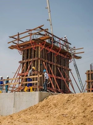
Lafey Construction Co. Ltd, consulted Orbital to carry out Bridge Setting Out Work and Construction. The work done using Topcon Total station include the control surveys, setting out of piers, CLs, embankments, leveling, OGL.
More Details... Photos VIEW PROJECT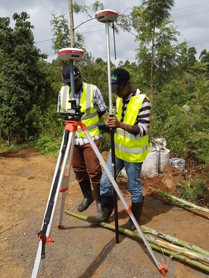
Voltalia from France had contacted and contracted Orbital Africa to execute a Topo and Route Survey for the Hydro Power generation project in a 16Ha of land in Meru County. Topo maps, DEMs etc were generated.
More Details... Photos VIEW PROJECT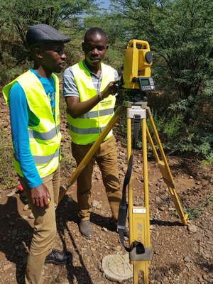
On Nov 2018, NIS and BRA in Somalia contracted Orbital to conduct training on operation of Topcon total station and AutoCAD Civil 3D. Twelve (12) staff members were trained for a period of One (1) Week.
More Details... Photos VIEW PROJECT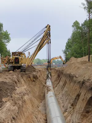
The project was executed on Jun-Jul 2018. Topcon GTS total station and Stonex A800A GNSS were used for control surveys whilst Stonex DL1000 level (X32) was used to obtain OGLs at 10-metre interval.
More Details... Photos VIEW PROJECT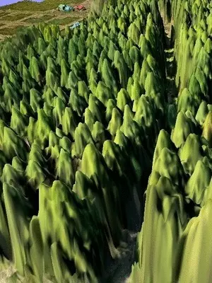
The Kenya Forest Service (KFS) contracted Orbital to carry out a project on UAV/Drone mapping of tree species in Mau forest. The 3cm spatial resolution images captured were analyzed using ERDAS.
More Details... Photos VIEW PROJECT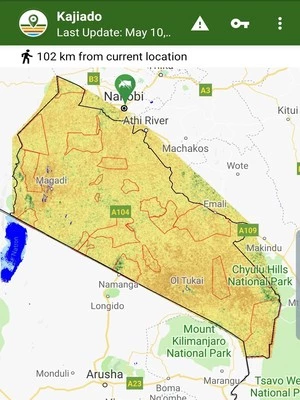
The PCI Global GIS mapping project and production of GIS layers for the AfriScout Mobile App was done in 2017-2019. GIS-based Mobile App helps pastoralists to find pasture and water for their herds.
More Details... Photos VIEW PROJECT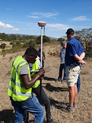
A S. African company Eddie Stemmet Bouers BK had contracted Orbital Africa to execute an Engineering and Topographical survey for the construction of a winery and a resort at Naivasha, Kenya.
More Details... Photos VIEW PROJECT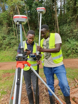
A detailed topo survey was conducted in three Hydro power generation sites i.e. Gitugu, Mihuti Kahinduni in Murang'a using Pentax GNSS Receiver and CORS enabling 1cm accuracy in X,Y & Z.
More Details... Photos VIEW PROJECT