GIS Mobile Data Collection
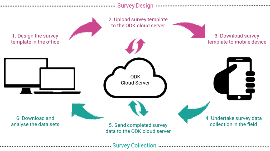
We carry out GIS Mobile Data Collection and Processing using GPS Enabled Devices and Mobile GIS Apps e.g. ODK, ArcPad, SuperPad, Survey123, EpiCollect, Survey CTO, CAPI and collector for GIS. The linking of GIS datasets through their spatial component often adds significantly to their value. It is this fact that has fueled the growth in demand for geographical information and the use of geographic information systems.
Orbital Africa offers a full range of data and services to create GIS databases and has supplied these services and solutions to clients in Eastern Africa region. To augment delivery of GIS data services, we also offer data capture services that covers all stages from spatial data collection, management, processing and analysis to the production and dissemination of the various outputs. Some of the key services that we offer to our clients include:
- Field data collection using GPS receivers, drones, smart apps; hardcopy data conversion using a variety of techniques including scanning and digitizing.
- Geospatial data analysis and interpretation through satellite/drone image processing, aerial photo interpretation, feature extraction and modeling etc.
- Data output and dissemination through cartographic map production and online map publishing using server GIS and other platforms e.g. a Geoportal.
