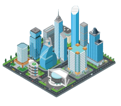
BIM, 3D AND SECTIONAL PROPERTY SURVEY SERVICES
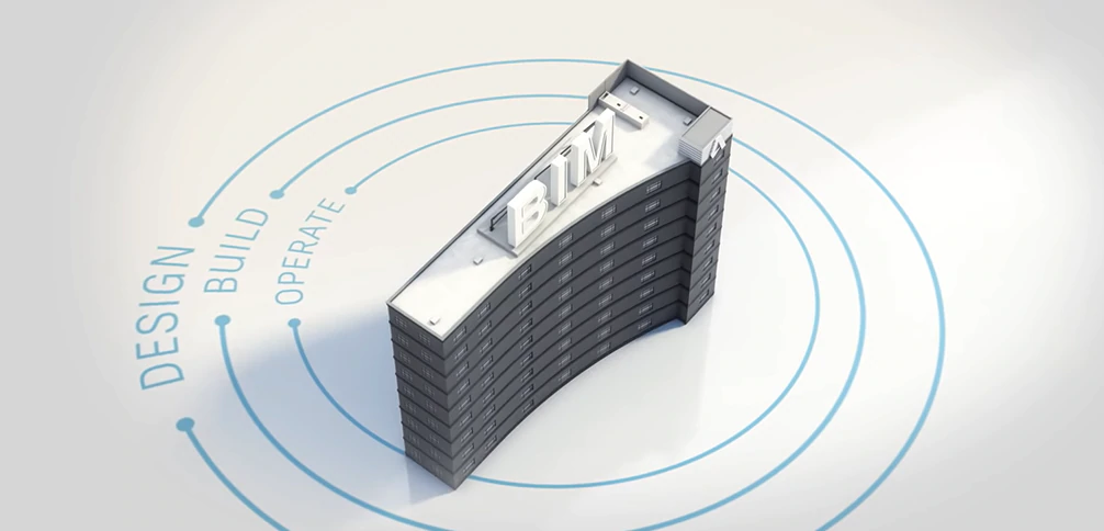
 Building Information Modeling (BIM) is a process supported by various tools, technologies and contracts involving the generation and management of digital representations of physical and functional characteristics of places. Building Information Modeling (BIM) is an intelligent 3D model-based process that gives architecture, engineering, and construction (AEC) professionals the insight and tools to more efficiently plan, design, construct, and manage buildings and infrastructure. Building Information Models (BIMs) are files (often but not always in proprietary formats and containing proprietary data) which can be extracted, exchanged or networked to support decision-making regarding a built asset. Current BIM software is used by individuals, businesses and government agencies who plan, design, construct, operate and maintain diverse physical infrastructures, such as water, refuse, electricity, gas, communication utilities, roads, railways, bridges, ports and tunnels. In short, Building Information Modelling (BIM) is the linking of people, technology and processes to improve outcomes in building and construction.
Why use Building Information Modeling (BIM)
 BIM is used to improve the efficiency of the construction process, reduce waste during the construction and to improve the quality and the efficiency of the buildings.
Many advanced industries have championed the concept of “Failing Fast.” That is, experimenting and trying new things – even if the first time around means failure – leading to another iteration and eventual success. In the high-stakes world of building and construction, this concept only works in the digital realm. Planning a build before any machinery hits the ground is the only way to “Fail Fast.” It’s not possible to experiment with bricks and mortar, and still survive in an environment typified by time and financial pressure, rapid deadlines, large and distributed working teams, and huge fiscal borrowing.
BIM is used to improve the efficiency of the construction process, reduce waste during the construction and to improve the quality and the efficiency of the buildings.
Many advanced industries have championed the concept of “Failing Fast.” That is, experimenting and trying new things – even if the first time around means failure – leading to another iteration and eventual success. In the high-stakes world of building and construction, this concept only works in the digital realm. Planning a build before any machinery hits the ground is the only way to “Fail Fast.” It’s not possible to experiment with bricks and mortar, and still survive in an environment typified by time and financial pressure, rapid deadlines, large and distributed working teams, and huge fiscal borrowing.
With traditional methods of construction, where teams move from one phase to another in the project, some information is lost from the previous phase. With BIM, information is collected digitally to be available when it is needed, wherever it is needed, by whomever it is needed. Adopting BIM means establishing a continuous flow of information. Every phase of the building process – from early planning and design, to construction, operation, maintenance and final recycling – is captured, digitally. This opens new possibilities for better efficiency, accuracy, collaboration and cooperation between the parties involved in the built. We live in an age of great automation. Every business process is digitalised, and every decision is driven by data. The World Economic Forum has pronounced this a “Fourth Industrial Revolution,” where connected machines, feeding from data, will exponentially transform processes in every industry.
Why Should you Adopt BIM?
- Via a rapid exchange of design information, different scenarios can be explored faster, allowing for more iterations of the architecture, structure and engineering systems and resulting in an accurate and optimised building design.
- All drawings can be captured into one comprehensive 3D model, avoiding information loss and enabling more educated decisions based on data.
- All geometric and spatial data required to perform energy calculations can be produced directly from the model.
- Ensuring compliance with environmental requirements is easier and the increased efficiency helps reduce building lifecycle costs.
- Detailed model contains all data and geometry required for accurate installation of MEP systems.
- Once the building is completed, the next version of the model will inform facilities management decision-making and systems, allowing for preventative maintenance and repair.
Building Information Modeling (BIM) and Geographical Information Sysyem (GIS)
If infrastructure project stakeholders want to manage the infrastructure of different classes, they must be able to operate on GIS and BIM as a continuum. It all depends on the type of information they need.
In the lifecycle of a construction project, BIM adoption brings a plethora of benefits; an important one among them is to make digital information a part of the deliverables for each stage. 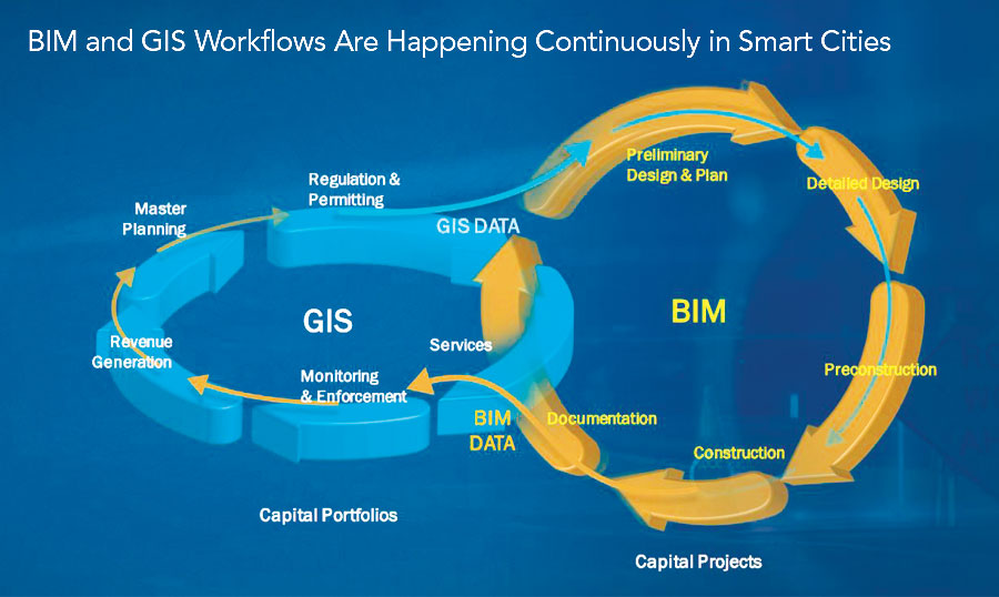 With the stakeholders being able to share the information among them more easily, they are able to take more coordinated and informed decisions at each stage.
Geographic information is an important component of the entire decision-making process in construction and nothing else than a GIS can enable everyone involved to become spatially aware most effectively. Using GIS enables people from different segments of the construction lifecycle to share a common picture of the project, provided by the GIS-generated maps. GIS must necessarily become the common visualization tool in the development sites.
GIS extends the value of digital BIM through visualization. Integration of BIM and GIS with time information, allows project participants to better understand the impacts of decisions before, during and after the construction of a project.
With the stakeholders being able to share the information among them more easily, they are able to take more coordinated and informed decisions at each stage.
Geographic information is an important component of the entire decision-making process in construction and nothing else than a GIS can enable everyone involved to become spatially aware most effectively. Using GIS enables people from different segments of the construction lifecycle to share a common picture of the project, provided by the GIS-generated maps. GIS must necessarily become the common visualization tool in the development sites.
GIS extends the value of digital BIM through visualization. Integration of BIM and GIS with time information, allows project participants to better understand the impacts of decisions before, during and after the construction of a project.
Why Integrate BIM and GIS?
 GIS is widely used for integrating, visualizing and analyzing information about real-world assets, such as buildings and transportation infrastructure, with surrounding context that may include environmental, demographic, structural, and scientific information. Maps that integrate GIS and engineering information are used to convey plans and status frequently in the initial stages of projects and during regular project updates.
The Web GIS approach allows the stakeholders to achieve a higher level of integration, wherein information from a variety of sources can get easily aggregated. This kind of integration offers a perfect way to capitalize on BIM data and synthesize it with other business systems such as asset management, space management at the campus or city scale.
Integration of BIM and GIS enables users to unlock the value in diverse data sets to enable applications including citizen engagement, sustainability analysis, disaster preparedness, and much more operational and management uses.
GIS is widely used for integrating, visualizing and analyzing information about real-world assets, such as buildings and transportation infrastructure, with surrounding context that may include environmental, demographic, structural, and scientific information. Maps that integrate GIS and engineering information are used to convey plans and status frequently in the initial stages of projects and during regular project updates.
The Web GIS approach allows the stakeholders to achieve a higher level of integration, wherein information from a variety of sources can get easily aggregated. This kind of integration offers a perfect way to capitalize on BIM data and synthesize it with other business systems such as asset management, space management at the campus or city scale.
Integration of BIM and GIS enables users to unlock the value in diverse data sets to enable applications including citizen engagement, sustainability analysis, disaster preparedness, and much more operational and management uses.
Keeping in view the developments taking place in the realm of BIM, especially around 3D modeling, the GIS capabilities 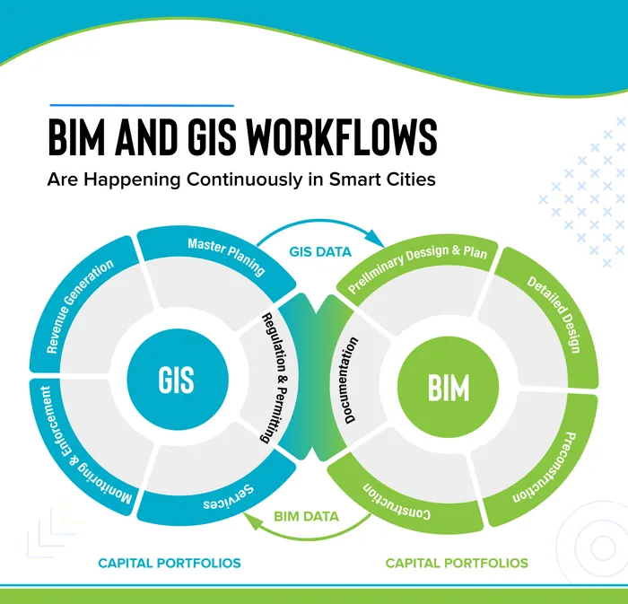 also need to mature to better adapt and handle BIM 3D content, visualizations, and analysis. These enhancements will help the GIS platforms to more completely address the key needs of the stakeholders in construction projects who want to realize more value from the data in which they have already invested to better manage the full lifecycle of their projects and assets.
The world of construction has historically limited itself to CAD and has not been concerned about georeferenced infrastructure. However, the scenario is changing since GIS can create data models that support both geometric and hierarchical needs which can address inside and outside infrastructure. Clients are demanding that the final as-built design is delivered digitally and georeferenced as this facilitates long-term maintenance of sites. Before building designs are created, GIS can play an important role in the selection of sites and integration of data throughout the process. GeoDesign has the potential to enable the stakeholders in a construction project make the best possible decisions that support the maximum infrastructure lifecycle at the least cost. Neither CAD nor GIS can do this on their own. In nutshell, digital construction can scale unsurpassable heights with efficient integration of BIM and GIS. We just need a more positive approach!
also need to mature to better adapt and handle BIM 3D content, visualizations, and analysis. These enhancements will help the GIS platforms to more completely address the key needs of the stakeholders in construction projects who want to realize more value from the data in which they have already invested to better manage the full lifecycle of their projects and assets.
The world of construction has historically limited itself to CAD and has not been concerned about georeferenced infrastructure. However, the scenario is changing since GIS can create data models that support both geometric and hierarchical needs which can address inside and outside infrastructure. Clients are demanding that the final as-built design is delivered digitally and georeferenced as this facilitates long-term maintenance of sites. Before building designs are created, GIS can play an important role in the selection of sites and integration of data throughout the process. GeoDesign has the potential to enable the stakeholders in a construction project make the best possible decisions that support the maximum infrastructure lifecycle at the least cost. Neither CAD nor GIS can do this on their own. In nutshell, digital construction can scale unsurpassable heights with efficient integration of BIM and GIS. We just need a more positive approach!
You can also request a quote for BIM, GIS and Sectional Property survey by sending us an e-mail at: geo@orbital.co.ke or call us on: +254-719-672296.