BC102 - Fundamentals of GIS and Mapping Course
Introduction
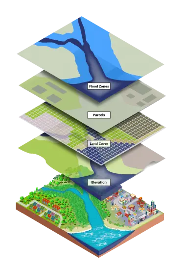
GIS is more than just software! People and methods are combined with geospatial software and tools, to enable spatial analysis, manage large datasets, and display information in a map/graphical form. GIS is now used by many organizations as a problem solving and decision support tool because of the capabilities it provides to map where things are, to map quantities, densities, finding what is nearby and so much more. This course introduces you to some of these capabilities in solving real world problems.
Course Overview
In this course, you will learn how to use GIS data for your own project, and how to create a well-designed map that effectively communicates your message. We will focus on the basic building blocks of GIS data, so that you know what types of GIS files exist, and the implications of choosing one type over another. We'll learn how to take non-GIS data, such as a list of addresses, and convert it into "mappable" data using geocoding. We'll also discuss metadata (which is information about a data set) so you know how to evaluate a data set before you decide to use it, as well as preparing data e.g., by merging and clipping files as needed. Additionally, we will explore how models can be used to automate tasks. Finally, we’ll learn about how to take data that we have found and prepared, and design a map using cartographic principles.
Course Objectives
- To develop an in depth understanding of GIS building blocks and what it can do;
- To map various vector and raster data in order to provide a better understanding of these models;
- To have an understanding of Cartographic and map design principles;
- To understand the fundamentals of Geospatial database creation and management.
Course Contents
- Mapping the real world using Vector and Raster data:
- Cartographic Map Design Principles:
- GIS File Types and data models;
- Spatial Reference Systems;
- Vector and Raster Data Models;
- Creating vector data models through basic digitizing, queries, vector attribute tables, calculating fields;
- Introduction to Raster Data Model; Rasterization; Basic raster analysis;
- Metadata – importance, viewing and editing metadata in ArcMap;
- Downloading and using GIS data;
- Making point data from coordinates and adding x, y data from a table;
- Geocoding using ArcGIS services;
- Introduction to Geoprocessing Tools; Clip, Buffer, Merge, etc.
- Design Principles: Visual Hierarchy, Figure-Ground Relationship, Contrast, Legibility, Visual Balance;
- Data Symbolization: Qualitative and Quantitative data;
- Map Elements: Title, scale Bar, Scale Text, Legend, Neat line, North arrow;
- Working with Labels and Annotations;
- Map Typography using Maplex;
- Creating a map layout in ArcMap;
- Exporting maps in ArcMap (jpg, pdf, svg etc.).
Expected Learning Outcomes
On completion of this course, the participants are expected to:- Have a full understanding of vector and raster data models;
- Be able to create vector data models and edit them;
- Be able to work with models and implement them in projects;
- Be proficient in creating high quality cartographic map layouts.
Training Materials (Hardware and Software)
- A Laptop or PC;
- ArcGIS Desktop;
- Quantum (Q-GIS).
Course Training Details
- Registration: Please register here: Register
- Training Intake: Feb, May, Aug and Nov every year.
- Location: Nairobi, KENYA {NB: The course can also be offered in any city within Africa}
- Duration: 5 Days
- Mode: Onsite or online
- Training Fee: Kshs. 29,000 or USD 350 {NB: Up to 20% discount for: (i) University/College students) (ii) A group of 5 or more participants}
Training Style and Approach
- Onsite instructor-led training;
- Online training (optional);
- Use of PowerPoint Slides;
- Practicals/Fieldwork Exercises;
- Use of Case Studies on GIS Data Creation.
Who Should Attend?
The training targets professionals from the following industries and sectors:- GIS/Geospatial Students;
- Urban/Spatial Planning Professionals;
- Regional Planning Officers;
- UN Bodies e.g., UNHABITAT, UNDP etc;
- Ministry of Urban Development;
- Urban Transport Sector;
- Academic Institutions;
- Civil Engineering Industry;
- Professionals from Health Sector;
- ...and many more!